

One Day in Yosemite’s High Country: How to Make the Most of Tioga Road

There is no question: if you have the time, you should plan a multi-day backpacking adventure into Yosemite’s High Country. It is one of the best ways to experience the park.
But we get it. Not everyone has three days, a wilderness permit, a backpack full of gear—or any interest in sleeping on the ground.
So if you have one day, we’ve got you.
Tioga Road gives you access to some of Yosemite’s most spectacular alpine scenery, and you can experience an astonishing amount of it between sunrise and sunset. The trick is knowing where to stop, what’s actually worth your limited time, and what you can realistically fit into a single day.
September happens to be one of our favorite times to answer that question.
Yosemite’s Tioga Road crosses some of the highest country you can reach by car in the park, traveling 47 miles between Crane Flat and Tioga Pass through forests, granite domes, alpine lakes and Tuolumne Meadows. It usually remains open into October or November, depending entirely on when the snow arrives. By September, however, services begin winding down, so this is the time to arrive prepared with food, water, layers and a full tank of gas.
And here's the secret to having a great day up there:
Don't try to see everything.
Choose one thing you really want to experience—a great hike, a day of fly fishing, or simply exploring the High Country—and build the rest of your day around it.
Echo's Favorite Day Hikes Along Tioga Road
One of the things we love about Tioga Road is the sheer variety of trailheads you can reach from it. In a single stretch of highway you can find everything from a one-mile walk to a 13,000-foot summit.
North Dome is one of our favorites for people who want a serious hike and a classic Yosemite payoff. Beginning at Porcupine Creek, the trail travels through forest before emerging onto the north rim of Yosemite Valley, directly across from Half Dome. The National Park Service lists it at 10.4 miles round trip and about five to seven hours. If you've still got some gas in the tank, take the short side trip to Indian Rock, a natural granite arch hiding along the route.

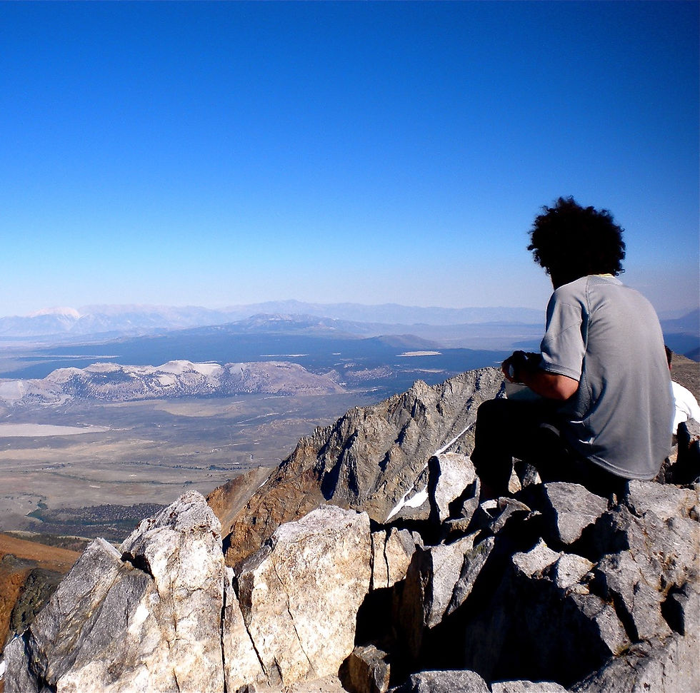
If alpine views are more your thing, Mono Pass might be our pick. The eight-mile round-trip trail climbs to roughly 10,600 feet and eventually gives you a spectacular view east toward Mono Lake, Bloody Canyon and the Eastern Sierra. It feels completely different from Yosemite Valley—and that's really the point of spending a day in the High Country.

Lembert Dome gives you a lot of reward in a shorter day. Combine it with Dog Lake and you're looking at about 3.8 miles and three to four hours, leaving plenty of time to explore Tuolumne Meadows afterward. From the top, you get a sprawling view over the meadow and surrounding peaks.

For experienced hikers who are comfortable at altitude, Mount Dana—often just called Dana Peak around here—is an entirely different beast. At more than 13,000 feet, it is one of Yosemite's highest peaks, beginning practically at Tioga Pass. This isn't the hike we'd choose for someone arriving from sea level that morning, but for strong, acclimated hikers looking for a High Sierra summit, it's hard to beat the view east over Mono Lake and west into Yosemite. The National Park Service lists Mount Dana at 13,057 feet.
Fly Fishing in Yosemite’s High Country
By late summer and early fall, some lower-elevation trout streams can become too warm for responsible catch-and-release fishing. California Trout recommends putting the rod away once water temperatures reach about 68°F, because warm water adds additional stress to trout that are already struggling with lower oxygen levels. Higher-elevation waters often remain considerably cooler.
That makes September a great time to head uphill.
Some of our favorite High Country lake options for brook trout include May Lake, Gaylor Lakes and Elizabeth Lake. If you prefer moving water, Lyell Canyon and the Tuolumne River through Tuolumne Meadows can offer beautiful stream fishing in an absolutely ridiculous setting.
May Lake is one of the easiest alpine lakes to reach. From the May Lake parking area, it is only about 2.4 miles round trip with roughly 485 feet of climbing. You cross forest and open granite before arriving at an alpine lake tucked beneath Mount Hoffmann and you'll even catch views toward Half Dome on the way.
Gaylor Lakes is another favorite, particularly in September. It is short, about 2.6 miles round trip, but don't confuse short with effortless. The trail begins near 10,000 feet at Tioga Pass and climbs steeply before dropping into the Gaylor Lakes basin. You can continue to Upper Gaylor Lake if you have time.And even if the fish aren't cooperating, it's hard to complain when you're standing in a meadow at 8,600 feet casting toward trout with granite peaks in every direction.
Fishing regulations inside Yosemite are a little different from many surrounding waters, so check them before you go. As of 2026, the Tuolumne River and its tributaries require artificial lures or flies with barbless hooks; rainbow trout are catch-and-release only there. A valid California fishing license is also required when applicable.
Of course, if you'd rather spend the day fishing instead of researching access, flies, regulations and where the fish are holding, this is exactly what our Echo Adventure Cooperative fly-fishing guides do.
Easy Sightseeing and Short Walks Along Tioga Road
You could also spend an extraordinary day in Yosemite's High Country without ever doing what most people would call a "hike."
Stop first at Olmsted Point, where the landscape abruptly opens toward Tenaya Canyon and the back side of Half Dome. Walk out onto the granite , enjoy the scenery, and keep an eye out for marmots!
Then keep driving, but go slow, the scenery is amazing!

Bring lunch and give Tenaya Lake more than a five-minute photo stop. It is Yosemite's largest easily accessible High Country lake, surrounded by granite domes and peaks, with several places along the shoreline to picnic and explore. If September hands you one of those impossibly warm Sierra afternoons, swimming and non-motorized boats are also allowed on the lake.
From there, head toward Pothole Dome. The walk is only about a mile round trip and gains around 200 feet, but from the granite you get one of the easiest broad views across Tuolumne Meadows.

Then slow way down.
Walk across Tuolumne Meadows to Soda Springs and Parsons Memorial Lodge. Soda Springs is exactly what it sounds like: cold, naturally carbonated water bubbling out of the ground, stained rusty by iron. The round-trip walk is only around 1.4 miles and mostly flat. Parsons Lodge itself has limited seasonal hours and may no longer be open by the time you visit in September, but the walk is worthwhile regardless.
Or walk the opposite direction toward Lyell Canyon. You don't need to commit to a destination. Follow the John Muir Trail beside the Lyell Fork of the Tuolumne River for as long as you feel like walking, then turn around. Even a couple of miles gives you a taste of what makes Yosemite's backcountry so special. NPS suggests Twin Bridges as an easy three-mile round-trip destination, or simply continuing farther into Lyell Canyon before turning back.
That's a pretty good Yosemite day, but you can also keep driving east if you want to make the most of your time in Yosemite!
Drive over Tioga Pass, which is the highest road crossing of the Sierra nearing 10,000 feet! The landscape changes from high alpine Sierra to the dramatic, dry Eastern Sierra. The drive itself is worth the extra time! Absolutely stunning!
The elevation drops quickly toward Highway 395 and Mono Lake, an ancient saline lake ringed with some of the strangest geology in California. The Tufas are coral like towers or strange stone chimneys that appear to grow around Mono Lake. They are actually created by chemical reaction that creates calcium carbonate, which builds up around underwater springs over time. The towers originally form underwater. As Mono Lake’s water level dropped, many of those formations were exposed, which is why you can now walk among them.

If you only have time for one stop, California State Parks specifically recommends South Tufa, where an approximately one-mile trail leads through the limestone tufa towers along the shoreline.
Then finish your extremely classy national-park adventure exactly as nature intended:
At a gas station! Whoa Nellie Deli, located inside of the Mobil is one of the Eastern Sierra's great road-trip institutions, perched above Mono Lake at the junction of Highway 120 and 395. Grab dinner, enjoy the view, and head back over Tioga Pass toward Groveland.
Accessible and Adaptive Stops in Yosemite’s High Country
If you use a wheelchair or mobility aid, have limited endurance, are traveling with someone who needs shorter walking distances, or simply need to build a lower-impact day, Tioga Road offers several ways to experience the High Country without making the adventure all about mileage.
Olmsted Point is probably our favorite place to start. Designated accessible parking is available, and the main viewpoint can be enjoyed directly from the parking area or from paved, wheelchair-accessible walkways. There is even a bronze tactile relief model of the surrounding landscape. The longer trail across the granite is not wheelchair accessible, but you don't need to take it to get the spectacular view toward Half Dome, Clouds Rest, and Tenaya Canyon.
Tenaya Lake is another wonderful place to slow down. Several parking areas provide opportunities to enjoy the lake from very close to the road, and one of the two picnic areas is wheelchair accessible. Portions of the north shore also have paved viewing areas, although not every route to the shoreline or beach is wheelchair accessible.
In Tuolumne Meadows, the trails toward Soda Springs and Parsons Memorial Lodge are mostly wide gravel surfaces and may work for some people using mobility aids. Conditions aren't universally accessible. The route near Parsons Lodge includes stone steps at the bridge, so this is one of those places where knowing your own equipment and abilities matters more than an “easy” label on a map.
And remember that accessibility isn't only about mobility. You're traveling at more than 8,000 feet for much of this day. A shorter itinerary, frequent breaks, shade, food, hydration, and the freedom to change plans can make the difference between pushing through Yosemite and actually enjoying it.
Rock Climbing near Tuolumne Meadows
Yosemite Valley may get most of the climbing headlines, but Tuolumne Meadows is one of the great granite climbing destinations in the world. Instead of the enormous walls of the Valley, the High Country is a landscape of sun-soaked domes, alpine spires, cracks, slabs and ridge lines—often with a considerably shorter approach and a very different Yosemite experience.

Some of the classics are hard to miss. Stately Pleasure Dome, sitting almost roadside near Tenaya Lake, is quintessential Tuolumne granite.
Daff Dome and Medlicott Dome rise nearby with everything from beautiful crack systems to some of the area's famously serious technical climbing. Fairview Dome is one of the iconic big domes of Tuolumne, with its sweeping granite face visible right from Tioga Road.
For a more alpine adventure, Cathedral Peak is one of our favorites simply because the setting is outrageous, the spire rises above Cathedral Lakes with the Sierra stretching out in every direction. Rock climbers have been seeking out Cathedral Peak for generations, and NPS identifies the Cathedral Lakes area as particularly popular with climbers and you can see our namesake, Echo Peaks!

And then there is Matthes Crest: a dramatic knife-edge granite ridge tucked farther into the Cathedral Range. It isn't a casual roadside climbing stop; it's a legitimate alpine objective with a longer approach and considerably more commitment. But if your definition of a perfect Yosemite day involves spending it hundreds of feet above the ground on a granite ridge, it belongs on the bucket list. Historical NPS planning documents identify Matthes Crest, Cathedral Peak, Fairview Dome, Daff Dome and Medlicott Dome among the signature climbs that helped define Tuolumne's climbing history.
This is technical rock climbing, not scrambling. Yosemite does not maintain climbing routes, conditions and loose rock can change, and climbers are responsible for their own safety and route-finding. Check current conditions and climbing closures before heading out; as of September 2026, Yosemite reports no climbing closures currently in effect, but closures can change.
Sunset and Stargazing Along Tioga Road
September has one other advantage: you don't have to stay out nearly as late to see the sunsets and stargazing.

If the weather is clear, throw a blanket and another layer in the car and stop at Tenaya Lake or Olmsted Point after dark. Yosemite National Park specifically identifies both as easily accessible High Country stargazing locations along Tioga Road.

Use a head lamp with red light or give your eyes 20 or 30 minutes to adjust, put the phone away, and suddenly your one-day High Country trip has a pretty spectacular ending.
How to Plan Your One Day in Yosemite’s High Country
You could spend years exploring Yosemite's High Country and still find another lake, trail, granite dome or ridgeline you've never seen before. Several of Echo's founding members have been exploring and guiding in the Yosemite region for more than 15 years, and we're still finding reasons to head back up Tioga Road.
That's why we don't recommend trying to cram North Dome, Tuolumne Meadows, Tenaya Lake, Mono Lake and six roadside stops into one heroic itinerary.
Choose your adventure first. Then build the rest of your High Country day around it.
Before heading uphill, stop by Yosemite Basecamp in downtown Groveland for outdoor gear, maps, crash pads, climbing books, fishing supplies and local advice on current conditions and where to spend your day. Whether you need a fly, forgot a piece of gear, need help choosing a trail or just want to talk through your plans with someone who knows the area, we're always happy to help you Adventure Like a Local.
If you'd rather let someone else handle the planning, Echo Adventure Cooperative offers private hiking, sightseeing and fly-fishing adventures throughout the Yosemite region, with trips built around your interests, abilities and the kind of day you want to have.
Looking for a guided climbing adventure? Rock-climbing instruction and guided climbing inside Yosemite National Park are offered through Yosemite Mountaineering School & Guide Service, Yosemite's authorized climbing guide service.


Comments